Adyar Basin Vision Framework
A 10-goal strategy tying Chennai's urban growth to the ecology of a river basin.
- 10Development goals structuring the framework
- 6Zones with tailored, zone-specific strategies
- 3Major Chennai river systems — Adyar is the southernmost
- 5Person core team, Sponge Collaborative
Problem
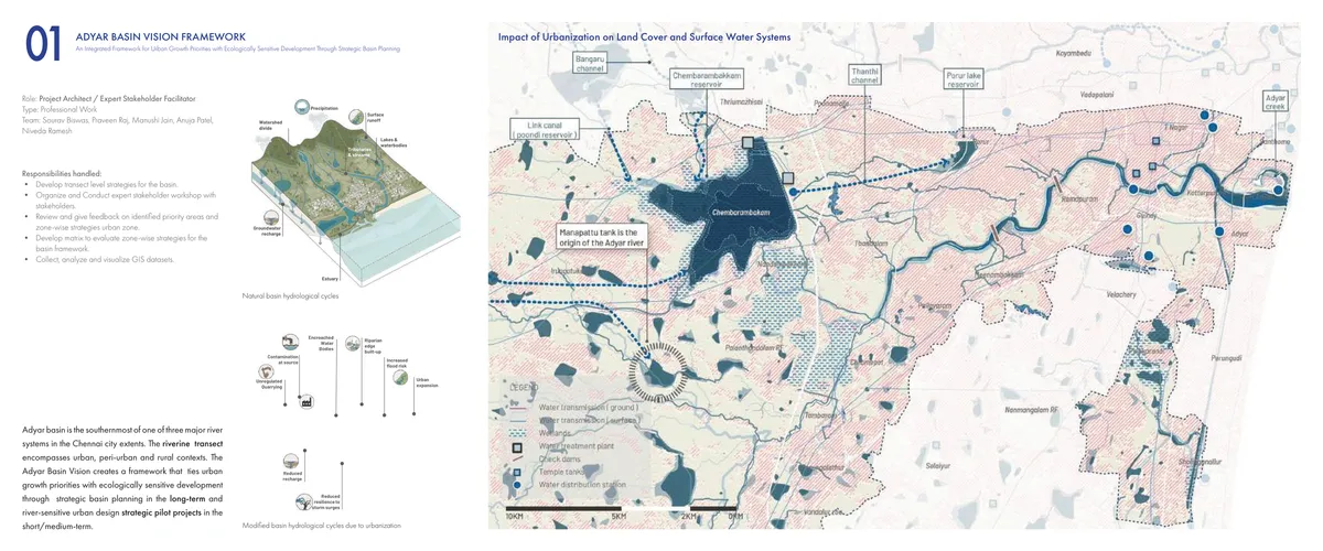
The Adyar is the southernmost of three major river systems running through Chennai, and its basin spans urban, peri-urban, and rural contexts in a single transect. Urbanization has been quietly rewriting the basin’s hydrology: encroached waterbodies, riparian edges built up to the water line, contaminated recharge, and rising flood risk where a natural system used to absorb runoff. The basin needed a framework that could hold both a long-term planning horizon and short-term pilot projects in the same document — one that a municipality could actually act on.
Approach
As project architect and expert stakeholder facilitator, I developed transect-level strategies for the basin, organized and ran the expert stakeholder workshop, reviewed zone-wise strategies, and built the evaluation matrix that scored them. The team collected, analyzed, and visualized the GIS datasets — watersheds, wetlands, water infrastructure, and land cover — that the framework is built on.
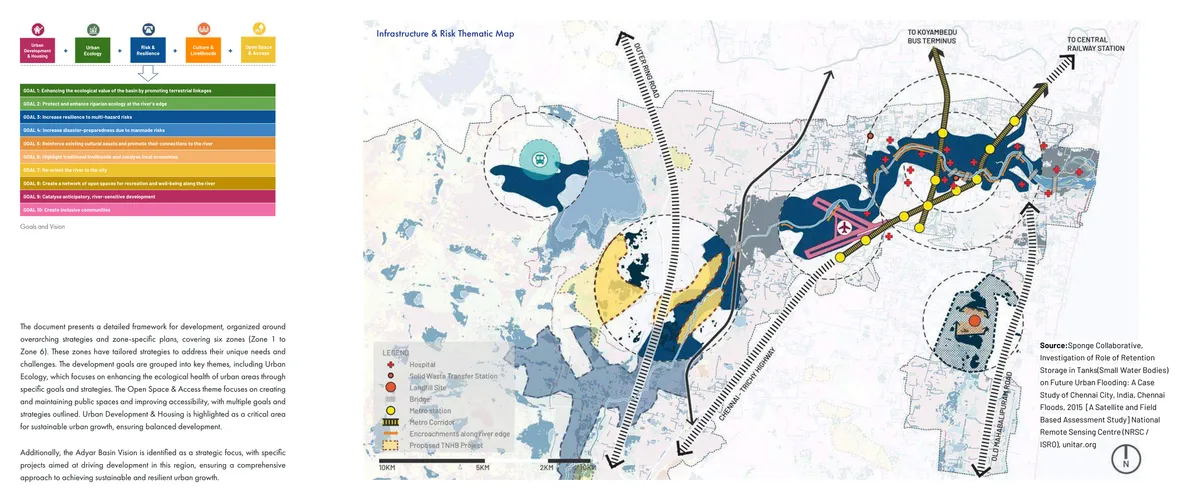
The ten development goals are grouped under five themes — urban ecology, risk and resilience, culture and livelihoods, open space and access, and urban development and housing — and mapped onto six zones, each with its own tailored strategy. A zone with high flood risk prioritizes water retention and storage; a zone near Guindy National Park prioritizes conservation-compatible development. The strategies aren’t generic best practice restated per zone — they follow from an infrastructure-and-risk thematic map built specifically for this basin.
| Source | Product | Access |
|---|---|---|
| GIS basin datasets | Watersheds, wetlands, water infrastructure, land cover | Collected and analyzed by the project team |
| National Remote Sensing Centre (NRSC/ISRO) | Satellite and field-based flood retention assessment | unitar.org |
| Expert stakeholder workshop | Priority-area review and zone-strategy feedback | Organized and conducted by the project team |
Results
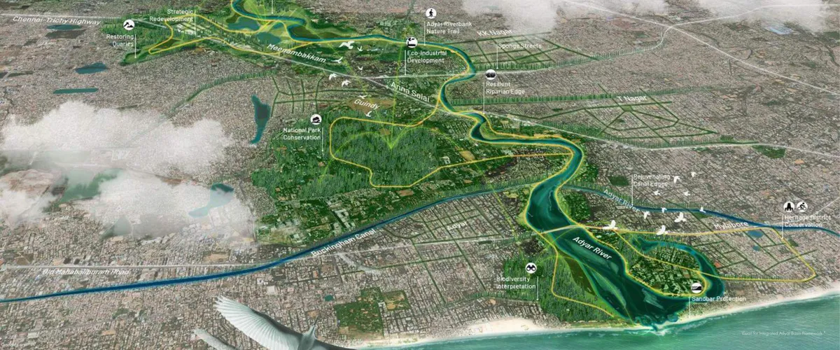
The vision resolves into a single continuous move: an eco-loop that threads Guindy National Park’s conservation core, “sponge streets” that let stormwater infiltrate rather than run off, a resilient riparian edge along the river itself, and heritage-district conservation where the river meets the city’s older fabric — ending at a protected estuary and sandbar at the coast.
What I’d do differently
The framework is strong on ecological and infrastructural logic but light on an explicit phasing and financing sequence — the kind of detail a municipality needs to move from vision to procurement. A companion capital-improvement schedule, zone by zone, would have made the framework immediately actionable rather than aspirational.
Share this page
https://abdulkalam.pages.dev/projects/adyar-basin-vision-framework/
Scan to open this page. Download the SVG for print.
